


New
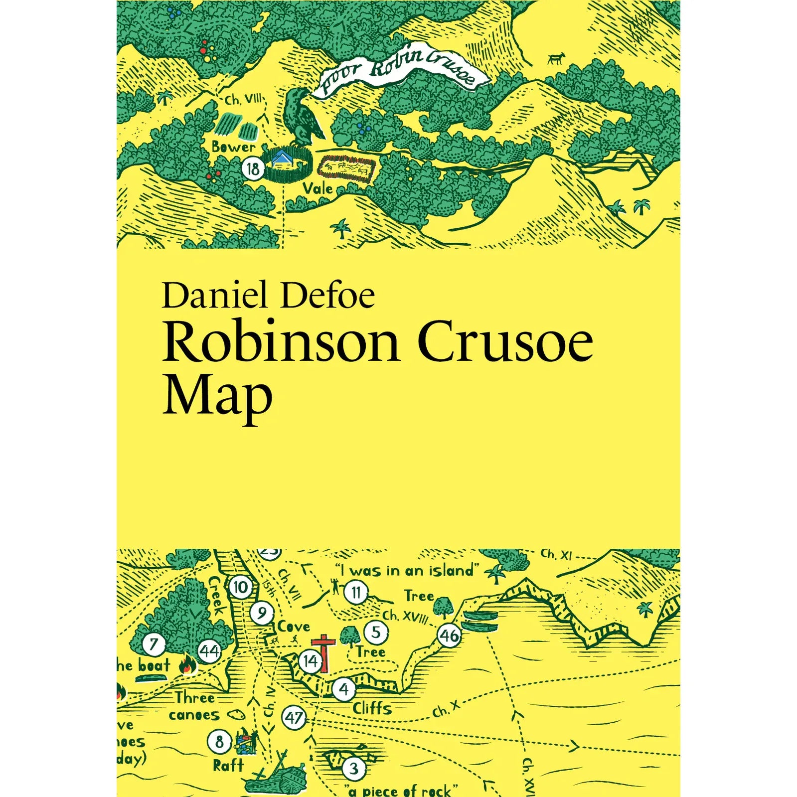
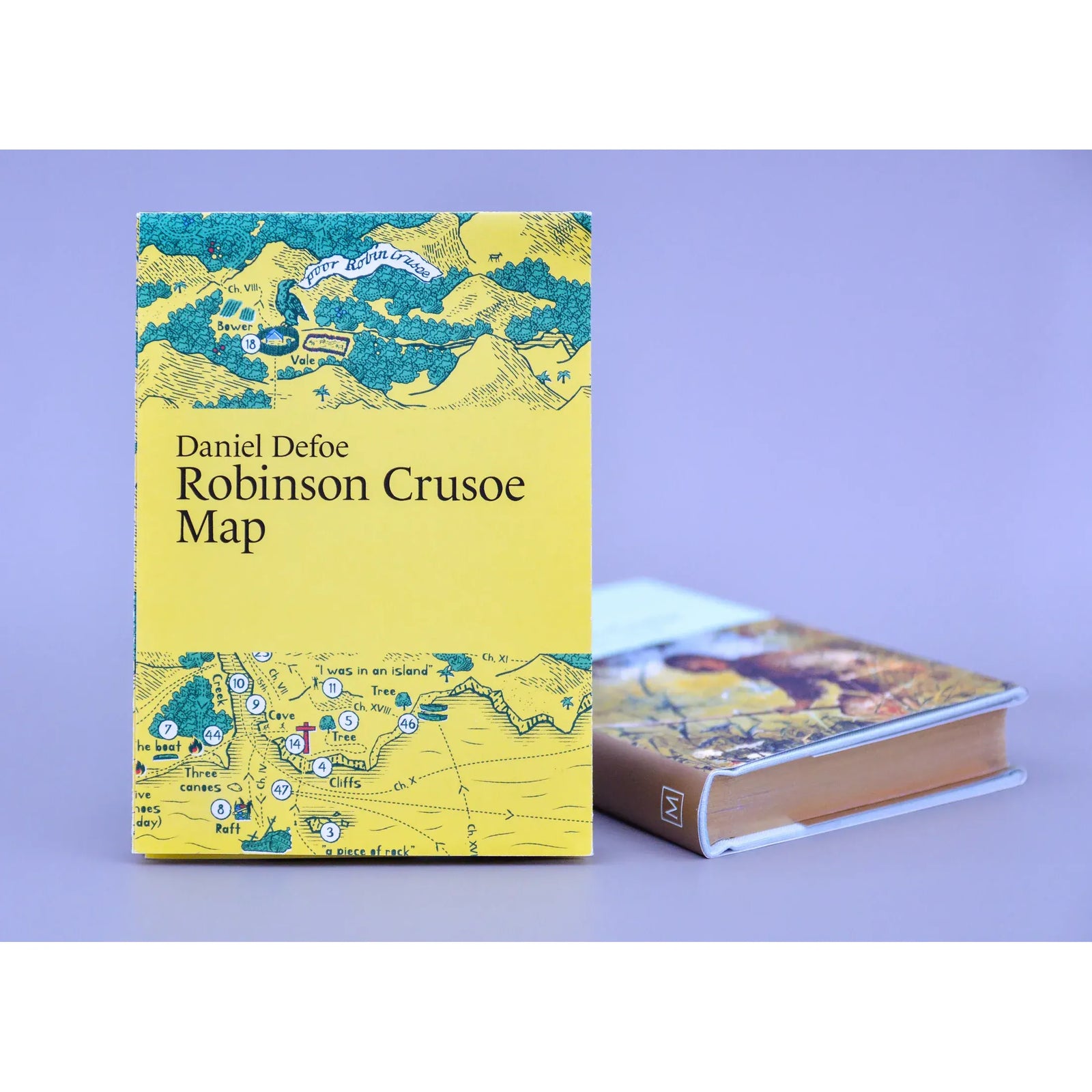
Daniel Defoe: Robinson Crusoe Map
$17.99
Twenty-Eight Years on an Island, Mapped in Full
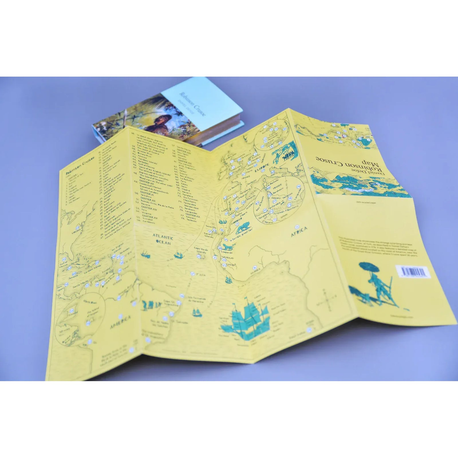
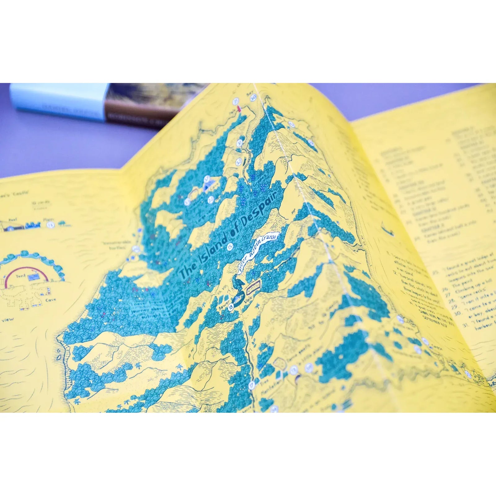
Daniel Defoe published Robinson Crusoe in 1719, and it is often cited as the first English novel — a story of survival, solitude, and the strange resourcefulness of a man left entirely to his own devices. Crusoe spent 28 years on an uninhabited island near the mouth of the Orinoco River, and this illustrated map shows every part of that world in detail.
The map traces the full arc of Crusoe's journeys as Defoe described them, including a detailed rendering of the island itself — its coastline, its shelters, its geography — alongside the wider routes that brought him there and eventually home. The kind of map that makes the novel feel newly vivid, whether you're reading it for the first time or the fifth.
Published by Literary Maps, created by map illustrator Martin Thelander, who makes detailed illustrated maps for classic books with places appearing in the order they're mentioned in the text.
Details
- Illustrated map only (not the full text)
- Printed size: 297 x 420 mm / 11.7 x 16.5 in.
- Folded size: 105 x 148 mm / 4.13 x 5.83 in.
- Printed on recycled, FSC-certified paper
Perfect For
- Readers of classic adventure fiction who want to follow every step of Crusoe's journey
- A gift for the reader who loves the novels that started it all
- Students and teachers exploring the origins of the English novel
Collections: All Products, Literary Guides, Literary Maps, New Arrivals