


New
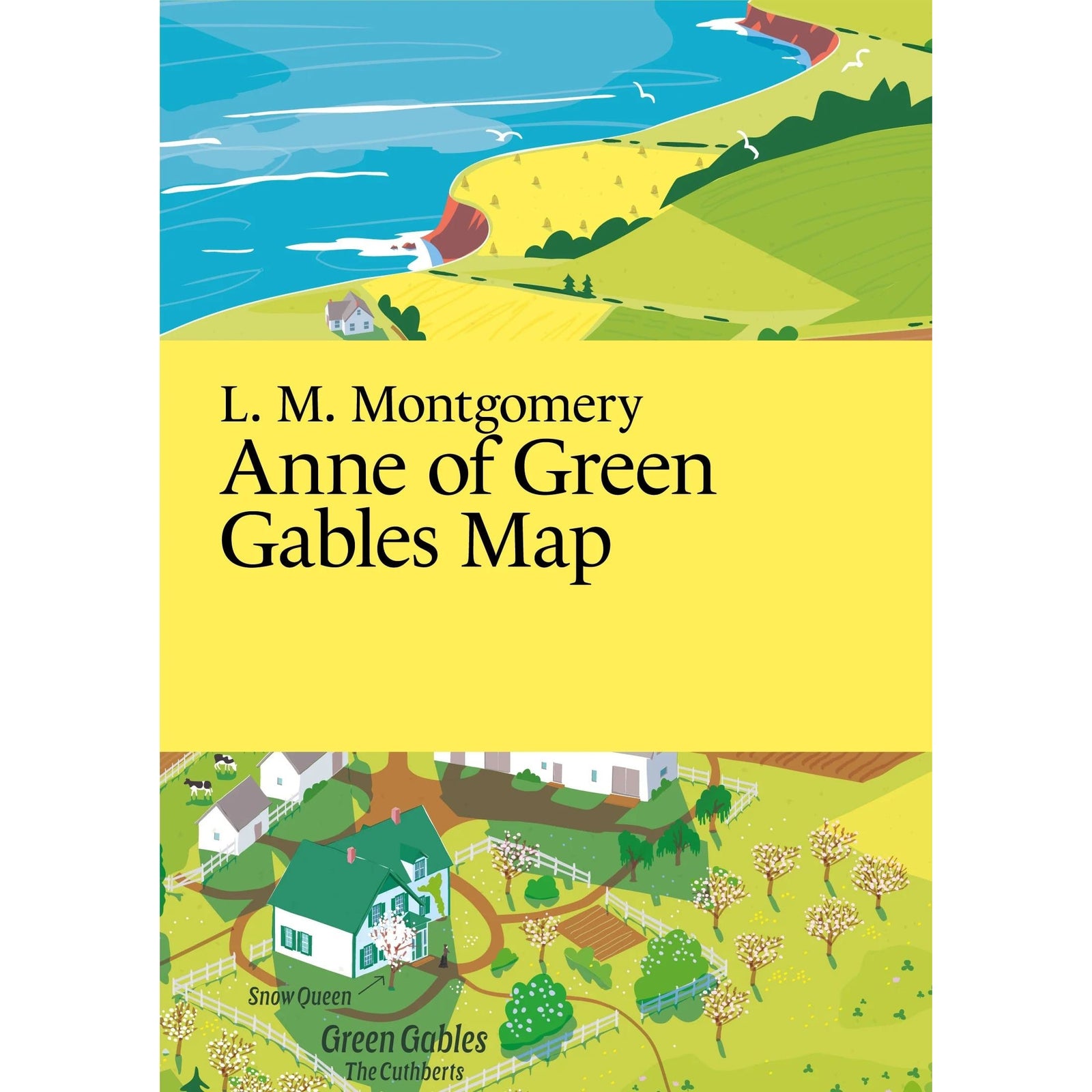
L M Montgomery: Anne of Green Gables Map
$17.99
Avonlea, Exactly as Anne Imagined It
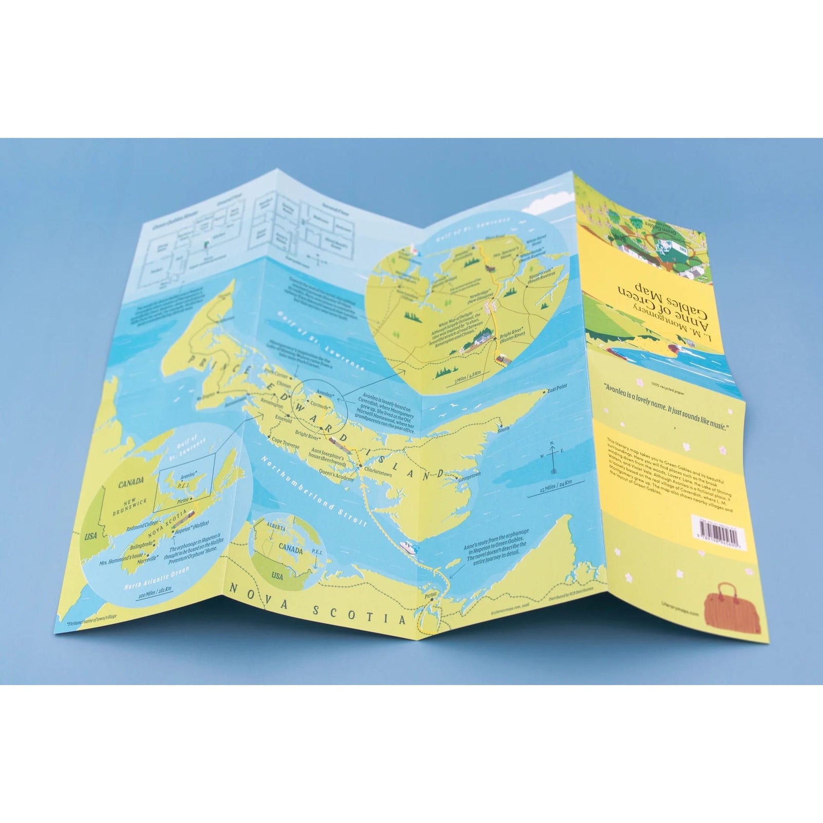
L. M. Montgomery published Anne of Green Gables in 1908 and created one of literature's most beloved heroines — a red-haired, fiercely imaginative girl who named every brook and lane and turned a quiet corner of Prince Edward Island into a world readers have been returning to ever since. If you've ever wanted to walk Lovers' Lane or find the Lake of Shining Waters, this map is for you.
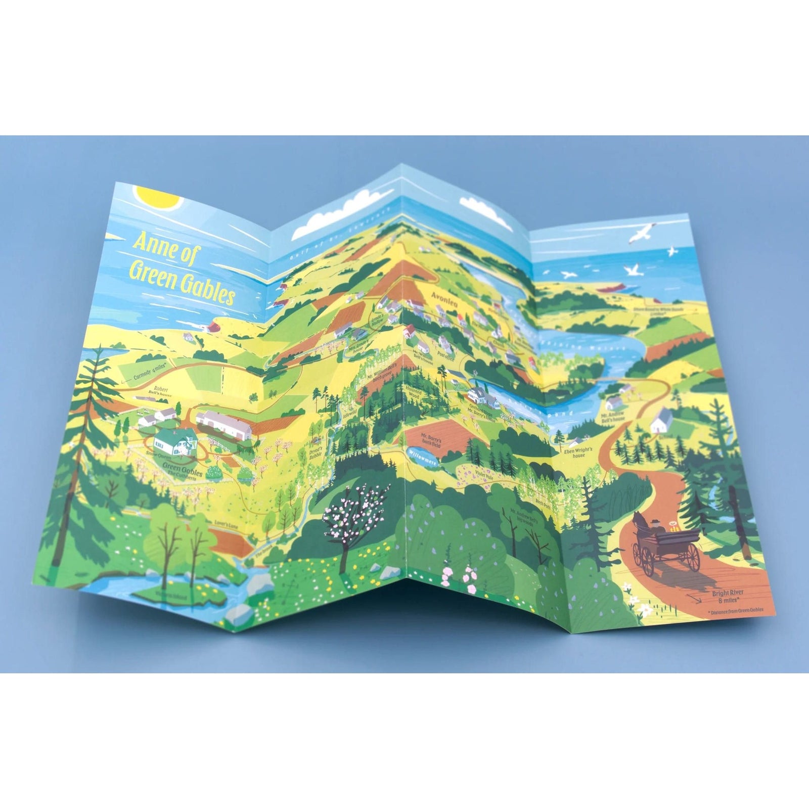
This illustrated literary map takes you to Green Gables and its surroundings — the brook winding down from the woods, Violet Vale, the layout of Green Gables itself, and the nearby villages of Avonlea. Although Avonlea is fictional, it is loosely based on the real village of Cavendish, where Montgomery grew up, and the map reflects that real landscape.
Published by Literary Maps, created by map illustrator Martin Thelander, who makes detailed illustrated maps for classic books with places appearing in the order they're mentioned in the text. The kind of thing you unfold next to a re-read and never quite put away.
Details
- Illustrated map only (not the full text)
- Printed size: 297 x 420 mm / 11.7 x 16.5 in.
- Folded size: 105 x 148 mm / 4.13 x 5.83 in.
- Printed on recycled, FSC-certified paper
Perfect For
- Readers who have always wanted to visit Avonlea and know exactly which lane they'd walk first
- A gift for the Anne devotee in your life — tucked inside a copy of the novel or given on its own
- Anyone who grew up with Anne Shirley and never quite grew out of her